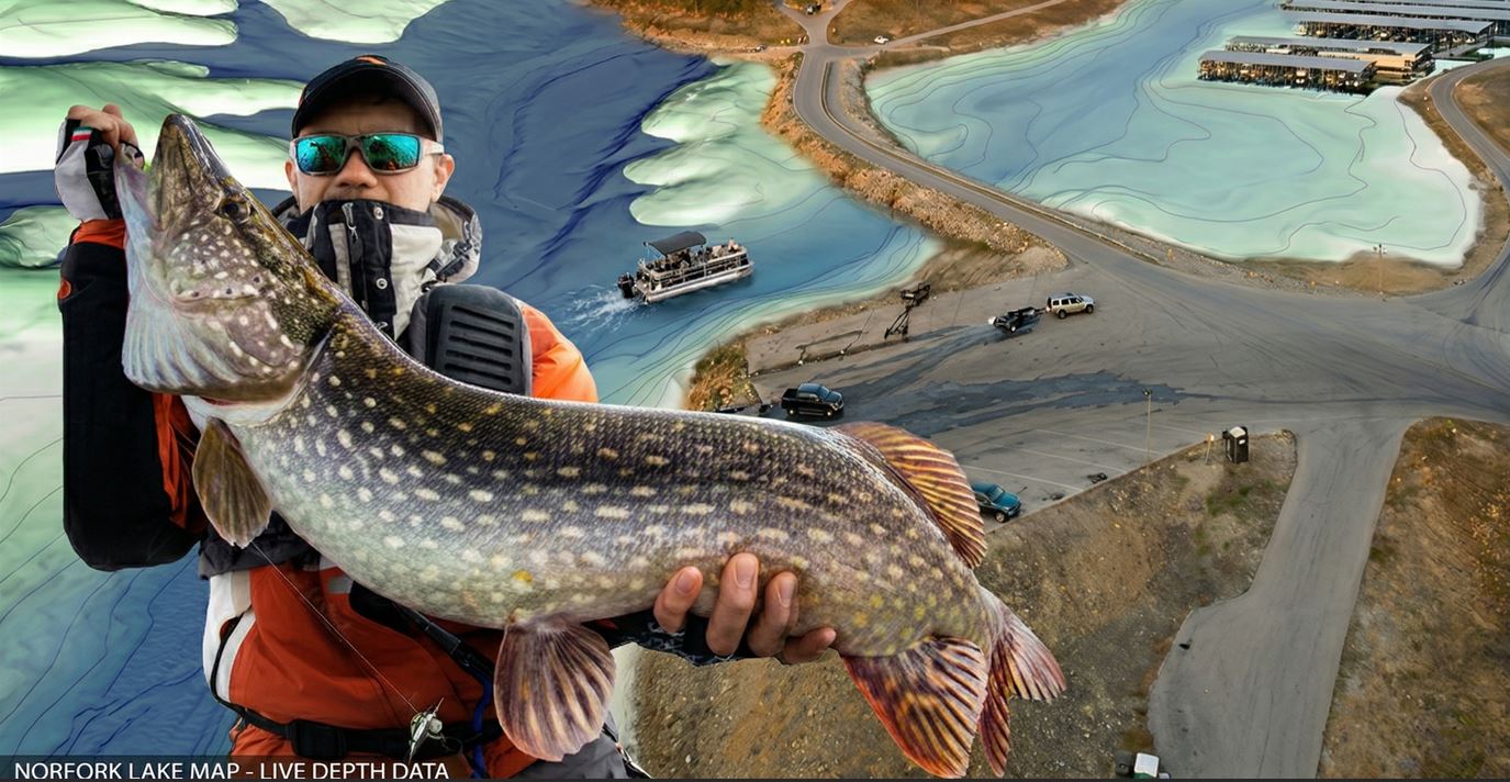
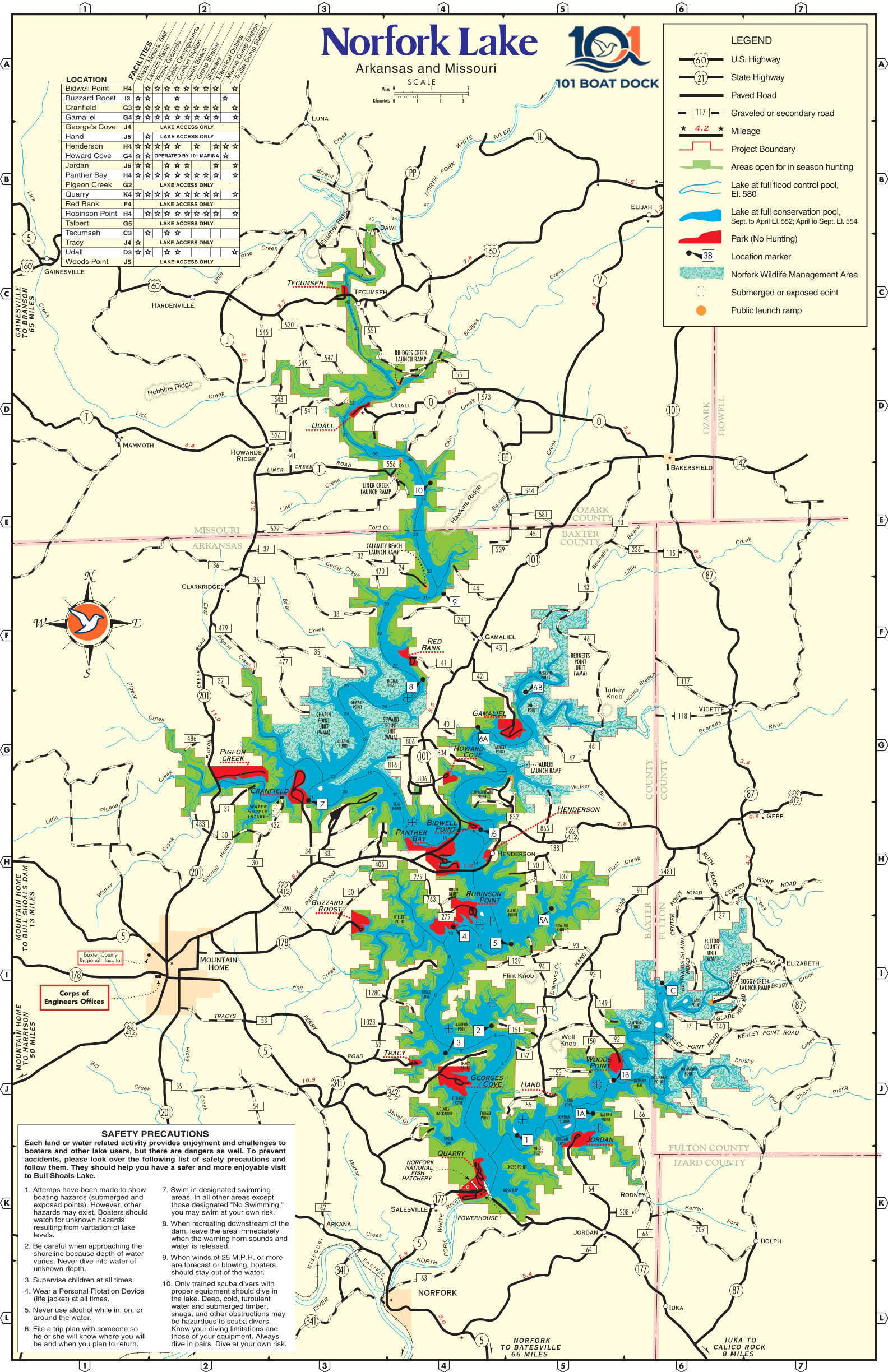
You know that lake resting lazily between Arkansas and Missouri? That is Norfork Lake, and in this guide, we present it to you with expert care—featuring updated maps for anglers, boaters, and curious tourists. To show you how current our data is: as of today, the water level is sitting at 553.75 feet above sea level.
Whether you are looking to navigate its shores without surprises or find the best fishing spots, we have you covered. May the lake welcome you with a smile and the perfect water level.
Interactive Norfork Lake Map (Live Navigation)
This interactive map is your best friend for your next adventure. Here is how to get the most out of it:
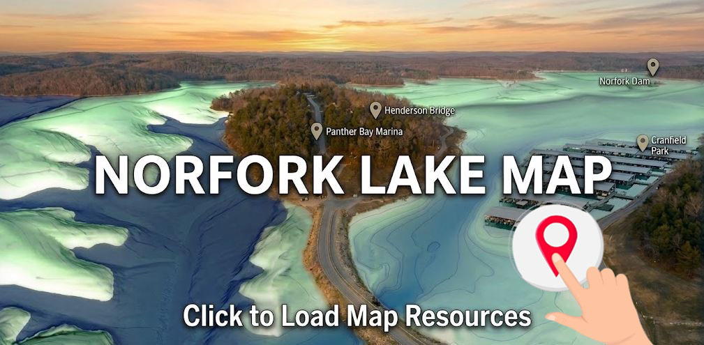
- Navigate like a pro: You can drag the map or use your fingers (on mobile) to move around. Use the scroll wheel or the + / – buttons to zoom into hidden coves, docks, or ramps.
- Explore the Markers: We have included key locations to get you started:
- Henderson Bridge: Ideal for Bass fishing with stunning views.
- Panther Bay Marina: Public ramp and a store for all your supplies.
- Norfork Dam: Deep waters and excellent Trout fishing downstream.
- Switch Layers for Detail: Click the layers icon 🗺️ in the top right corner to toggle between:
- Standard Map: Shows streets, roads, and names.
- Satellite View: Perfect for spotting unmarked boat ramps, marinas, and clearings in the vegetation.
Pro Tip: In Satellite view, lighter water tones usually indicate shallower areas. Always cross-reference with the current level of 553.75 ft to ensure your favorite ramp is accessible.
Fishing Map and “Brush Pile” Locations (Underwater Structures)
The secret to Norfork Lake isn’t just on the surface; it’s what’s hidden beneath. To catch trophy Bass and Walleye, you must locate artificial structures.
The Fish Magnet: “Brush Piles”
Because the lake has clear waters and rocky bottoms, local anglers and the AGFC (Arkansas Game and Fish Commission) have installed hundreds of “brush piles” (submerged trees and brush).
- Bass: Typically patrol the edges of the brush looking for baitfish.
- Walleye: Prefer structures in deeper zones, especially where the bottom transitions from gravel to rock.
Fishing Hotspots
- Henderson Bridge: The bridge pillars create currents and shadows that attract both Largemouth and Smallmouth Bass. The depths around the structure are perfect for vertical jigging.
- Norfork Dam Area: Famous for deep, cold waters—the perfect Walleye habitat. The steep slopes and rock structures near the dam are mandatory stops for any serious angler.
Our Live Interactive Map tracks real-time fishing activity across the lake’s most productive structures. By combining technical data from the AGFC with local reports, we pinpoint exactly where the schools are moving.
Norfork Lake Depth and Topography Map
Norfork Lake Depth Radar
Our interactive chart tracks the deepest sections of the lake. We combine technical AGFC bathymetry with current pool levels to pinpoint strategic deep-water channels.
The bathymetry of Norfork Lake features the rugged underwater relief typical of Ozark reservoirs. With an average depth of 60 feet (18m) and reaching up to 180 feet (54m) near the dam, the bottom follows the old North Fork River bed. According to USGS elevation data, the lake presents steep slopes and narrow channels winding through flooded valleys.
Contour Lines and Navigation Hazards
Navionics data reveals drastic variations near limestone cliffs, where the depth can drop vertically from 15 to 100 feet within a very short distance.
- Safety Warning: Boaters should watch for extended rocky “points” and standing timber (submerged trees).
- Low Water Alerts: During lower elevation periods, these structures and sandbars at creek entrances become surface hazards that require constant sonar monitoring.
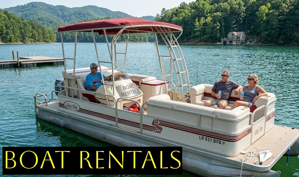
Service Guide: Boat Ramps, Camping, and Marinas
⚓ MARINA & PARK AMENITIES
Norfork Lake Access Points Guide
Public Access: Top Launch Ramps
Finding the right entry point depends on your vessel and the current water level. Primary ramps like Panther Bay and Tracy Ferry offer the most reliable access year-round.
Camping and Recreation Areas
Based on data from Recreation.gov, Norfork Lake offers a variety of amenities. Most sites include:
- Restrooms and shower facilities.
- Electric hookups (30/50 amp).
- Easy access to the shoreline for swimming.
Download Norfork Lake PDF Map (Mobile Optimized)
For those exploring remote arms of the lake where 5G/LTE signals are unstable, we provide a high-resolution digital map designed for mobile devices.
🗺️ DOWNLOAD PDF MAP- Offline Reliability: Works via your device’s native GPS—no signal required.
- Battery Efficiency: Stops your phone from constantly searching for towers, saving power for photos.
- Total Compatibility: Optimized for Avenza Maps, Apple Books, or Adobe Acrobat.